
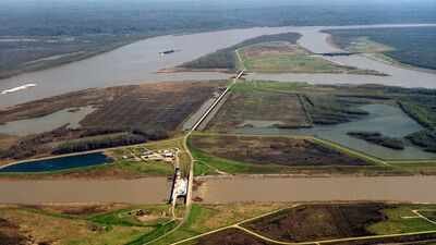
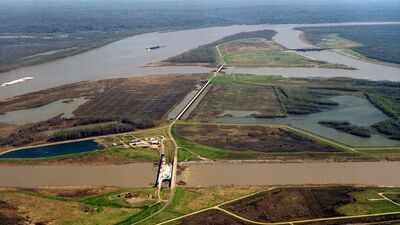
Nearly 2,000 kilometres of levees built along the Mississippi River over the past century helped protect cities and farmland from major floods. But the barriers also caused one of North America’s most serious ecological losses. By cutting coastal estuaries off from vital river sediment, the flood control system has contributed to the loss of about 4,900 square kilometres of Louisiana’s coastal land since the 1930s. Without fresh silt spreading across the delta during annual floods, large areas of coastal marshland have slowly sunk beneath the Gulf of Mexico. Detailed maps and scientific records from the United States Geological Survey (USGS) show that Louisiana lost nearly 1,900 square miles of coastal land between 1932 and 2010. To slow the damage, environmental agencies are now reversing the original engineering approach by pumping river mud back into damaged bayous to rebuild the coastline.
Starving the delta of river silt
Historically, the Mississippi River regularly overflowed its banks during spring floods. These events spread millions of tonnes of mud, sand and organic silt across the vast delta. The natural process helped balance the sinking of the land and protected the coast from waves and tropical storms. After major floods in the early 20th century, the US Army Corps of Engineers built an extensive network of levees stretching about 2,000 kilometres along the lower river. The levees successfully kept floodwaters within the river channel. But they also sent the river’s huge sediment load into the deep Gulf of Mexico instead of allowing it to settle in nearby coastal areas. In its detailed analysis, USGS Circular 1375 found that artificial levees, along with navigation channels and oil industry canals, had greatly changed the flow of water across coastal Louisiana. Without new sediment to balance land sinking and rising sea levels, saltwater moved further inland, killing marsh plants and washing away coastal soils until they became open water.
Rebuilding Barataria from the riverbed
To address the damage, state and federal agencies are carrying out large marsh creation projects using sediment taken directly from the riverbed. One major example is the Upper Barataria Marsh Creation Project, described in reports from NOAA Fisheries and its federal partners. The Barataria Basin alone has lost nearly 300,000 acres of land since the 1930s. The loss was made worse by the 2010 Deepwater Horizon oil spill. To rebuild part of the upper basin, contractors working for the Louisiana Trustee Implementation Group used hydraulic dredges to remove about 8.4 million cubic yards of sediment from the Mississippi River. The muddy mixture was then pumped through pipes for more than 13 miles into areas of drowned marshland. The amount of material was enough to fill the Caesars Superdome twice. The project created 1,259 acres of new land and shallow-water areas, beating its original target by 76 acres. The restored area includes 1,170 acres of new wetland marsh and 89 acres of connected tidal ponds and waterways designed to recreate the way historic bayous once functioned.
Biological recovery along the bayou
Monitoring data published by NOAA Fisheries and collected with The Water Institute show that native plants and animals are quickly returning to the newly created land. Field crews working 12-hour shifts in the Upper Barataria marsh have found white shrimp, brown shrimp, blue crabs and red drum using the newly built tidal creeks just one year after construction ended. Native marsh plants have also grown naturally across the raised mudflats. Community volunteers added to the effort by planting 500 cypress saplings in selected areas. The restoration sites have carefully placed gaps in their dikes. These openings allow tides to carry nutrients into the marsh while also letting young fish and shellfish move freely between the new wetlands and the wider basin. The project is backed by a 20-year monitoring and adaptive management plan overseen by federal and state trustees. USGS scientists will use field data to guide future changes, including possible adjustments to water flow or targeted replanting if the land sinks faster than vegetation can grow. The restored marshes cover only a small part of the 4,900 square kilometres Louisiana has lost over the past century. But the successful return of Mississippi River sediment to the Barataria Basin offers a working model for rebuilding damaged deltas across southern Louisiana.