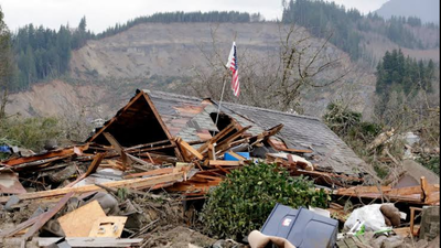
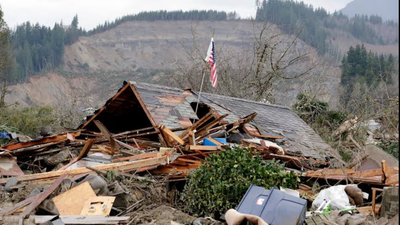
An estimated 6.5 million Americans live in homes built on or next to landslide-prone land, according to a major national study by the University of Washington.By studying 128 million buildings across the United States, researchers created the Landslide Exposure Database (LED). It is the first detailed national map showing how landslide hazards overlap with where people live.The findings, published in Earth’s Future, an AGU journal focused on sustainability, reveal a major gap between urban and rural communities in both landslide risk and their ability to recover.
Mapping local risk at the building level
Unlike large disasters such as hurricanes or floods, landslides affect very small areas where the level of danger can change sharply over short distances.“The susceptibility at one location can be vastly different than the susceptibility at a neighboring location just 10, 20 or 30 meters away,” said Joseph Wartman, a civil engineer at the University of Washington and co-author of the study. “We have never considered the human geography of landslides; this is really the first attempt to do that.”To create this detailed map, lead author Daniel Acosta-Reyes and his team combined USGS landslide maps, building footprint data, and nighttime occupancy models. Nighttime occupancy helps estimate risk when people are asleep and less able to evacuate quickly.“This is really a template that we should be able to duplicate in other nations and other parts of the world,” Acosta-Reyes said.
Population density increases eastern exposure
Although the steepest mountains are in the western US, Alaska, and Hawaii, these regions have fewer people, so they account for only a small share of those exposed to landslides. Together, the Rocky Mountains, Alaska, and Hawaii make up about 4% of the exposed population.Instead, more than half of Americans living in landslide-prone areas are in eastern states. Because of higher population density, even relatively flat states such as Illinois, Minnesota, and Nebraska have more than 700,000 people living on or near hazardous slopes.
The urban-rural recovery gap
The researchers also used US Census Bureau socio-economic data to study how well communities can recover after landslides. Rural residents make up 62% of people living in landslide-prone areas, but they often have fewer financial resources and less public infrastructure to rebuild after damage.“Technically, a landslide is not insurable, so if you lose your home in a minor landslide event, that’s going to be a personal expense and a catastrophic loss for the homeowner,” said Ben Mirus, a USGS research geologist who was not involved in the study.This problem is especially clear in the Appalachian Highlands, from northern Maine to central Alabama. In West Virginia, where 70% of the state is prone to landslides, the high cost of rare flat land pushes many lower-income families to live on steep, more dangerous hillsides.“We have found that this urban-rural divide plays out across the entire United States,” Wartman said. He added that wealthier cities often reduce risk by building high-density housing on flat land or by using engineering to make hillside developments safer.
Different policy solutions for cities and rural areas
For wealthier cities where people choose to build homes on scenic but risky slopes, such as Seattle and San Francisco, the researchers recommend stricter zoning rules and policies that place recovery costs on homeowners.For lower-income rural areas, especially in Appalachia where housing choices are limited, the study recommends more public investment in early warning systems, rainfall monitoring, and federal disaster assistance.
Why better mapping matters
Researchers say the new database could help governments make better decisions long before a landslide happens. Instead of relying only on broad regional hazard maps, officials can now identify individual buildings and neighborhoods that may face higher risk. This allows local authorities to prioritise inspections, improve evacuation planning, and target investments in protective infrastructure where they are needed most. The same approach could also help emergency managers estimate how many people might be affected during heavy rainfall or other triggering events.The database is also expected to support future research into how changing weather patterns may influence landslide exposure. Scientists have long recognised that intense rainfall is one of the biggest triggers for landslides in many parts of the United States. As climate change increases the frequency of extreme precipitation in several regions, communities already located on unstable slopes could face greater risks over time, making accurate exposure mapping even more valuable for long-term planning. While the database does not predict when or where the next landslide will occur, it provides a stronger foundation for land-use planning, disaster preparedness, and public awareness by showing where people and infrastructure are most exposed.