

A significant winter storm, known as Winter Storm Fern, is expected to affect a broad area of the United States over the weekend, posing a threat of significant snowfall, ice accumulation, and dangerous road conditions to the Southern and Eastern regions. Millions of people are in danger of being left without power, having roads impassable, or sustaining property damage as a consequence of frozen accumulation pushing trees and power lines to give way. The upcoming storm combines two very rare weather elements: a high-pressure system of Arctic origin that advances with cold temperatures to a southern direction, agreeing with a Low-pressure system moving east through the Southwest, with high humidity.
Heavy snow, sleet, and freezing rain prompt winter storm alerts in the South
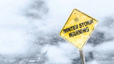
“Winter storm watches have already been issued in the South, with forecasts of heavy snow, freezing rain, and sleet,” according to the National Weather Service. These notices will be followed by Winter Storm Warnings and Ice Storm Warnings, affecting the regions expected to receive the most adverse weather conditions, once the weather picks up in intensity. In some areas, the accumulation of ice is expected to make road conditions impassable and could cause trees and power lines to fail, leaving thousands of people without power for several hours or even days.
Weekend snowstorm alert in the South: Friday, Saturday and Sunday
Friday: Snow, Sleet, and Freezing Rain Hit the Southern Plains
Winter Storm Fern is expected to start impacting the Southern Plains Friday morning, with snow, sleet, and freezing rain spreading across Oklahoma, northern and western Texas, Arkansas, and northern Mississippi. These conditions will make travel extremely dangerous, especially on highways and rural roads.By Friday night, the storm will shift southward and eastward, moving into the lower Mississippi Valley, Tennessee Valley, and Appalachians, with effects reaching parts of Virginia and the Carolinas. Precipitation will continue in the Southern Plains while spreading into new regions.
Saturday: Intensifying Snow, Ice, and Sleet
Saturday will see the storm gain strength, bringing heavier snow and ice to Texas, Louisiana, Mississippi, Alabama, and continuing to Kentucky, Tennessee, West Virginia, Virginia, and the Carolinas. Dangerous road conditions, combined with accumulating ice, may lead to power outages and fallen trees.By Saturday night, precipitation will extend to the Texas Gulf Coast, southwestern Louisiana, central Mississippi, northern Alabama, northern Georgia, and South Carolina. Snow and ice will spread into the mid-Atlantic, reaching major cities along the East Coast. Roads will remain hazardous, and travel will be extremely risky.
Sunday: Storm Slowly Weakens, but Hazards Remain
Sunday will see precipitation gradually decrease in Texas, but conditions will persist across Louisiana, the Tennessee Valley, Appalachians, Carolinas, and Northeast states. Snow and ice may linger into Sunday night or Monday, prolonging travel dangers and making recovery efforts more difficult.
Freezing rain and snow set to create hazardous conditions for millions
One of the most serious hazards of Winter Storm Fern is the accumulation of ice. There could be enough ice from Texas up through the Carolinas to make travel on roads extremely slippery, knock down trees, and cause power outages everywhere. People are being advised to avoid travel where possible, keep emergency supplies ready, and stay informed about updates from local authorities.While exact snowfall totals remain uncertain, large swaths of the Southern Plains and the Mid-Atlantic are expected to see significant snow accumulations combined with sleet and ice. The worst travel conditions could make roads impassable, particularly in rural and hilly areas such as the Appalachians. Drivers should expect hazardous and slow-moving traffic and consider delaying unnecessary travel.
Why is this storm so severe
Winter Storm Fern is powered by a rare meteorological combination:
- Arctic high: Cold air from the Great Lakes moves south, lowering temperatures throughout the South.
- Southwest low-pressure system: The moisture moves north from the Southwest into the cold air and creates widespread snow, ice, and sleet.
When all these things converge, the result is a high-impact winter event that will affect millions of people across multiple states.
Preparing for winter storm fern
Residents in the storm’s path should take proactive steps:
- Monitor weather alerts continuously.
- Prepare for potential power outages lasting several hours or days.
- Avoid travel during peak snow and ice periods.
- Ensure heating systems are functional and emergency supplies are stocked.
With preparation and caution, communities can minimise the impact of Winter Storm Fern, which may become one of the most significant storms of the season.